Introduction: Introduction
- Map of Loch Coirib and Loch Measca
Return to table of contents
Refer to Map

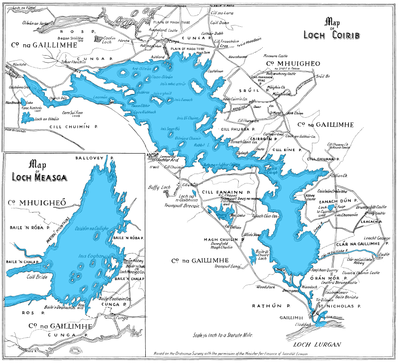
This is a scan of the map with accompanied the book. It is based on the Admiralty Chart made in 1846, and the Ordnance Survey Maps, shows the principal islands, the navigation course, the rivers, and the chief objects of interest along its shores.
Larger versions of this map are also available:
- Medium size (800x730)
- Large size (1024x934)
- Super size (2048x1864)
!! Warning: you need at least 64MBytes of memory to open the super sized image. Opening on computers with lower quantities of memory may take a very long time, or may crash the computer.